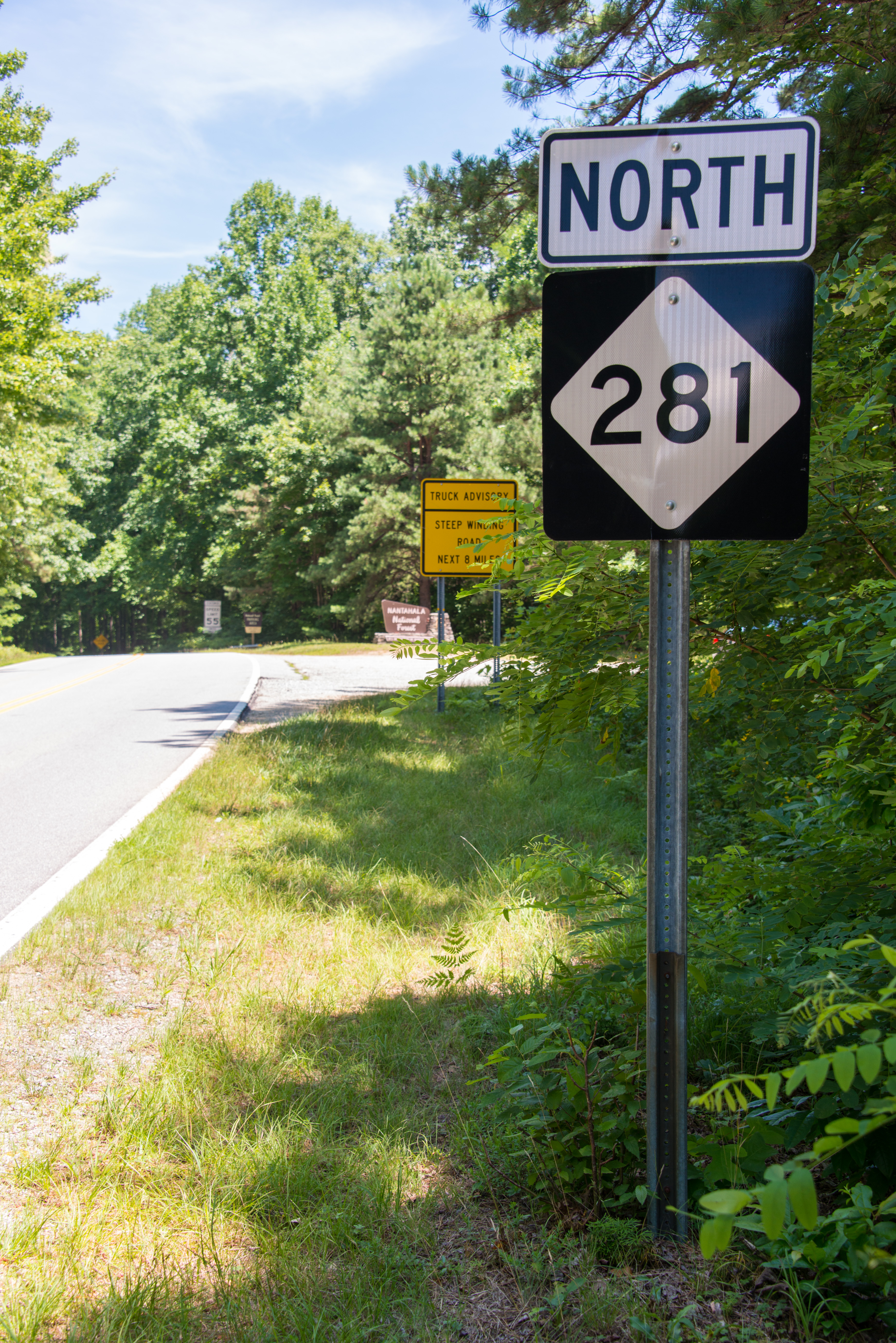
North Carolina Highway 281 on:
[Wikipedia]
[Google]
[Amazon]
North Carolina Highway 281 (NC 281) is a primary

NCRoads.com: N.C. 281
281 Transportation in Jackson County, North Carolina Transportation in Transylvania County, North Carolina
state highway
A state highway, state road, or state route (and the equivalent provincial highway, provincial road, or provincial route) is usually a road that is either ''numbered'' or ''maintained'' by a sub-national state or province. A road numbered by a ...
in the U.S. state of North Carolina
North Carolina () is a state in the Southeastern region of the United States. The state is the 28th largest and 9th-most populous of the United States. It is bordered by Virginia to the north, the Atlantic Ocean to the east, Georgia and So ...
. The highway runs north–south, connecting communities in western Jackson County and scenic areas of southwest Transylvania County
Transylvania County is a county in the U.S. state of North Carolina. As of the 2020 census the population is 32,986. Its county seat is Brevard.
Transylvania County comprises the Brevard Micropolitan Statistical Area, which is also included i ...
. It is the only North Carolina state highway that changes numbers when crossing into South Carolina
)''Animis opibusque parati'' ( for, , Latin, Prepared in mind and resources, links=no)
, anthem = " Carolina";" South Carolina On My Mind"
, Former = Province of South Carolina
, seat = Columbia
, LargestCity = Charleston
, LargestMetro = ...
.
Route description
NC 281 is a two-lane mountain highway that begins at the South Carolina state line in Jackson County, before quickly entering Transylvania County. In South Carolina, the road continues south as SC 130. It runsconcurrent
Concurrent means happening at the same time. Concurrency, concurrent, or concurrence may refer to:
Law
* Concurrence, in jurisprudence, the need to prove both ''actus reus'' and ''mens rea''
* Concurring opinion (also called a "concurrence"), a ...
with US 64 near Sapphire
Sapphire is a precious gemstone, a variety of the mineral corundum, consisting of aluminium oxide () with trace amounts of elements such as iron, titanium, chromium, vanadium, or magnesium. The name sapphire is derived via the Latin "sapphir ...
, then goes east where it splits and continues north to Lake Toxaway. Continuing northwest, the highway becomes aggressively curvy, steep, narrow and in a couple of locations is a gravel road. NC 281 crosses back into Jackson County at Owens Gap (, highest point on route), near Round Mountain to the northeast. The road widens again near the Tuckasegee River
The Tuckasegee River (variant spellings include Tuckaseegee and Tuckaseigee) flows entirely within western North Carolina. It begins its course in Jackson County above Cullowhee at the confluence of Panthertown and Greenland creeks.
It flows ...
and passes by several lakes before ending in Tuckasegee.
The overall route shows the very best of what the Nantahala National Forest
The Nantahala National Forest ( /ˌnæntəˈheɪlə/), is the largest of the four national forests in North Carolina, lying in the mountains and valleys of western North Carolina. The Nantahala is the second wettest region in the country, after the ...
has to offer, but it is not recommended for commercial trucks, recreational vehicles or buses. In the winter, the highway can be considerably dangerous in snow and ice, and should not be attempted without proper equipment.
Scenic byways
Whitewater Way is a byway from near Sapphire to the South Carolina state line. It is named after the Whitewater Falls, which, at , are the highest waterfalls east of the Rockies. Various other falls can also be found alongHorsepasture River
The Horsepasture River is an U.S. Geological Survey. National Hydrography Dataset high-resolution flowline dataThe National Map , accessed April 26, 2011 National Wild and Scenic river in the U.S. states of North Carolina and South Carolina. The ...
and multiple trails connect the area with rare shortia
''Shortia'' is a small genus of subshrubs or perennial herbs in the family Diapensiaceae. There are five species, four in Asia and one in the Appalachian Mountains of eastern North America. They are found in mountainous areas, generally from el ...
found in the area. The byway is not recommended for recreational vehicles or buses.
History
NC 281 was established in 1930 as a new primary route, from NC 28, in Lake Toxaway, to NC 106, in Tuckasegee. In 1980, NC 281 was extended west along US 64 overlap, from Lake Toxaway to near Sapphire, and then along new primary routing to theSouth Carolina
)''Animis opibusque parati'' ( for, , Latin, Prepared in mind and resources, links=no)
, anthem = " Carolina";" South Carolina On My Mind"
, Former = Province of South Carolina
, seat = Columbia
, LargestCity = Charleston
, LargestMetro = ...
state line. Purpose of the route's extension was to connect visitors to the Whitewater Falls overlook area, maintained by the United States Forest Service
The United States Forest Service (USFS) is an agency of the U.S. Department of Agriculture that administers the nation's 154 national forests and 20 national grasslands. The Forest Service manages of land. Major divisions of the agency inc ...
. In January 1985, NC 281 was rerouted along Slick Fisher Road (SR 1306), north of Lake Toxaway; however in April of same year, NC 281 was reverted along its original routing. Around 1987, SC 130 was extended north from SC 11, near Salem, as a new primary routing to meetup with NC 281 at the state line; becoming the only non-continuous route number between the two states.
Junction list

References
External links
*{{commons category-inlineNCRoads.com: N.C. 281
281 Transportation in Jackson County, North Carolina Transportation in Transylvania County, North Carolina